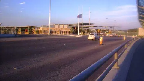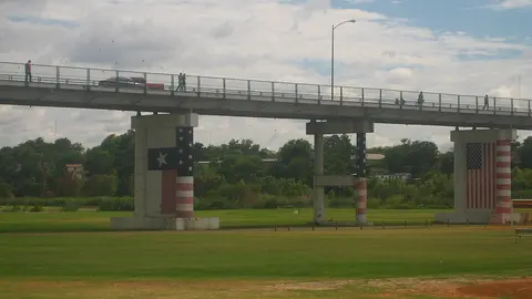
What the Eagle Pass Bridge 1 cameras show
Between the two of them you get the whole line. One travels along the bridge, with the cars lined up on it and the Eagle Pass booths in the background; the other moves through the downtown streets the line comes in on. Neither one stays on a single shot, so give them a few seconds.
The bridge and its line, from a camera that sweeps the area
This is a motorized camera, mounted up high, that changes its framing on its own. On its sweep it shows Bridge 1 lengthwise, with the blue canopy that runs alongside it and the cars lined up on top; it moves in on the booths at the Eagle Pass port of entry, across the river, and then swings toward the streets and rooftops of downtown Piedras Negras.
The view you want is the one of the bridge: if cars fill it from end to end, the wait is long; if there's only a line near the booths, you'll get across soon. Since the camera doesn't hold still, at times it shows only the city: wait for it to come back to the bridge. The picture carries the time and, along the bottom, ads from its owner.
The downtown streets the line backs up onto
This is the city government's stream, and it isn't a single camera: every few seconds it moves on to another of several fixed cameras downtown, each with its own label. You see Calle Hidalgo next to the bridge, the corner of Abasolo and Zaragoza, Calle Matamoros, the Gran Plaza from above and the entrance to Bridge 1, with its flags and, across the river, the grassy bank on the Eagle Pass side.
It's the one to check for how far back the line goes before you get close: when cars are lined up on Hidalgo or Abasolo, the line has already spilled off the bridge. If those streets look clear, the wait is only on the bridge itself. Each view carries the date and time.
About Eagle Pass Bridge 1
In Mexico it's Puente Internacional I; in Texas it's Eagle Pass Bridge I, which is how CBP lists it. It's the historic crossing between the two cities. The first bridge for carriages went up in 1890, and a flood carried it off that same year; the one that came next was rebuilt in 1927 and again in 1954, after a flood, and was reinforced in 1985. It's narrow, just two lanes, and about 1,850 feet long. The Mexican side is run by CAPUFE, Mexico's federal roads and bridges agency, and the U.S. side by Eagle Pass.
Getting there and where it lets you out
On the Mexican side you come in through downtown: the entrance is at Abasolo and Hidalgo streets, on one side of the Gran Plaza. This is where Mexico's Federal Highway 57 ends, the road up from Saltillo and Monclova. On the Texas side the same route continues as US 57 along Garrison Street, a few blocks from Main Street.
Car lanes at Eagle Pass Bridge 1
Bridge 1 is for cars, in two lines: the general lanes (CBP calls them "standard") and the Ready Lane, for travelers carrying a document with an RFID chip. Commercial trucks can't use it: since 1999 they have all been inspected at Eagle Pass Bridge 2, the Camino Real International Bridge. The wait time CBP publishes for this bridge is the one for cars.
Best time to cross Eagle Pass Bridge 1
CBP updates the number every hour, and the arrow next to each lane tells you whether the wait is going up or down. The usual pattern on the border is a longer line into the U.S. early on weekdays, and on weekends and holidays in either country.
The alternative is close by: Bridge 2 is a little over half a mile downriver and has more lanes. The Eagle Pass bridges page puts both in the same list, with the faster one on top. Outside the city, the other crossing in the Eagle Pass & Del Rio area is the Del Rio bridge from Ciudad Acuña, about 50 miles upriver.
Frequently asked questions
Is Eagle Pass Bridge 1 open 24 hours?
No. It closes at night; its hours are shown at the top of the page, with the CBP data. The one that's open 24 hours is Bridge 2.
What's the difference between Eagle Pass Bridge 1 and Bridge 2?
Bridge 1 is the downtown one: narrow, cars only and closed at night. Bridge 2 is a little over half a mile downriver; it's wider, carries the cargo and doesn't close.
Can trucks cross at Eagle Pass Bridge 1?
No. Bridge 1 is for cars only. Commercial trucks cross at Bridge 2, where they have all been inspected since 1999.